Project Summary, Nanga Parbat
The National Science Foundation requires proposals to have a project summary that is generally intelligible,
and not aimed only at specialists. We tried!
Proposal Summary
We propose a multidisciplinary study of the Nanga Parbat-Haramosh Massif of the northwestern Himalaya, Pakistan. We wish to assess the recent and still-active processes responsible for an extraordinary episode of very young high-grade metamorphism, partial melting, high strain, and rapid denudation focused around the center of Nanga Parbat. Our ultimate goal is to exploit the excellent exposures and access to active tectonic processes offered by Nanga Parbat to understand the mesoscale interaction between petrological and mechanical processes during collisional orogenesis. In particular, we wish to evaluate from an active-system perspective which specific processes are most important in reworking the crustal lithosphere, and whether these processes are in fact those traditionally associated with continental collision. To accomplish these goals we propose to integrate a wide variety of measurements made using techniques of geochronology, petrology, stable-isotope geochemistry, radiogenic tracer-isotope geochemistry, seismology, magnetotelluric sounding, structural geology, and geomorphology, and then place our results into a geodynamic context. Using this multidisciplinary approach, we would first characterize the evolution and current state of the Indian crust making up the Nanga Parbat massif, then document the processes responsible for this evolution, and finally aim to combine this information into a coherent model applicable to other (older) orogens.
In (somewhat more) Plain English:
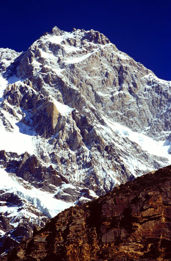
Scientific Rationale. Nanga Parbat, the westernmost 8000 meter peak of the Himalaya, provides perhaps the world's best exposures of rocks which are being subjected to the forces and chemical processes that occur during the collision of continents. Our plan was to use Nanga Parbat as a natural laboratory to study these processes while they are still active, for Nanga Parbat is world-renowned as a site of what is, from a geologist's perspective, extraordinarily rapid uplift and erosion at rates of 5 or so mm/yr, which is equivalent to 5 kilometers per million years. Processes at these rates can have significant impact on temperatures in the crust and in the crust's stength.
Planned Measurements. To fully understand how the rocks of Nanga Parbat have been deformed and modified, we used a broad variety of techniques to determine how material is entering and leaving the Nanga Parbat region, including structural geology and geomorphology as well as seismological and electromagnetic probes of the crust immediately beneath Nanga ParbatWe also used a variety of geochemical and dating techniques to better understand how the crust of Nanga Parbat was created and is being modified.
Natural hazards. The rapid uplift and erosion of Nanga Parbat is accompanied by recurring seismicity and all manner of erosive processes including massive landslides (e.g., the 1841 slide which actually blocked the Indus River for several months). Our investigations of the seismicity and geomorphology of the Nanga Parbat massif provided important data for risk assessment, pertinent to the Karakorum Highway, which traverses the northwestern edge of the Nanga Parbat massif, and also for present and planned dams on the Indus River. The November 2002 pair of medium-scale but devastating quakes underscores the hazard potential of this region.
Project History. This project is in many ways the culmination of many years of collaboration between U.S. geologists and geologists at the National Centre of Excellence in Geology at the University of Peshawar. This originally began in the 1970's as the "Dartmouth-Peshawar Project," with work in the Himalayan foothills on Siwalik Group sediments by Gary Johnson, Noye Johnson, Neil Opdyke, Javed Khan, Rashid Tahirkheli, and many other students and colleagues. in 1983, Peter Zeitler completed his Ph.D. on rocks in the mountains of northern Pakistan, and later, Peter Zeitler and Page Chamberlain carried out several NSF-funded projects in these mountains that set the stage for this large Continental Dynamics project. Several of the scientists involved in the Nanga Parbat project have worked together for some 25 years on the fascinating and complex geology of northern Pakistan.
Project Budget, Funding, and Timetable. Full funding for this project was approved by the Continental Dynamics Program of the U.S. National Science Foundation. We were extremely fortunate to be funded by this high-visibility, major-project program, which each year approves only a few projects. The budget for our project was U.S. $2.1 million, with a project start date of 1 May, 1995. A significant amount of this budget was spent in Pakistan on field logistics and supplies as well as collaborative activities. The project was initially budgeted for a duration of three years, and later extended to a total of six years to cover final publications and completion of student work.