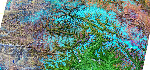
SE Tibet Thematic Mapper satellite image of southeastern Tibet. Tsang-po River wraps around Namche Barwa-Gyala Peri massif in center right part of image, the river reversing course by 180 degrees. Orographic gradient in rainfall clearly visible from lower elevations at bottom right (southeast) to higther elevations on Tibetan Plateau to left (west).
Credit: William Kidd
Image copyright by photographer: email for permission to use