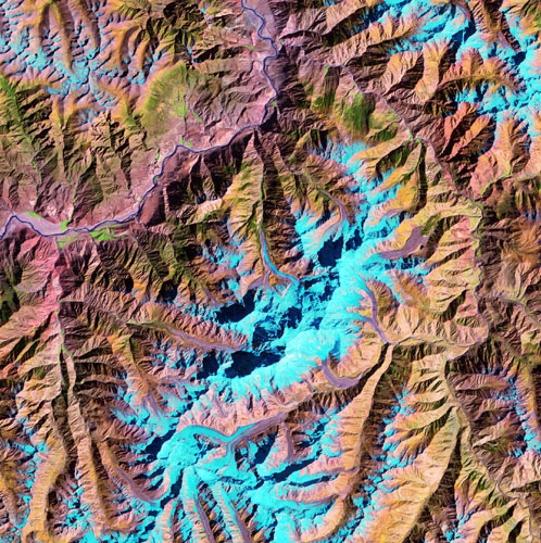
TM Image, Nanga Parbat Thematic Mapper satellite image of Nanga Parbat massif, NW Pakistan. Snow and ice are in light blue, water is dark blue to black, vegetation is in shades of green, and rock and sediment are in brown and reddish shades. Summit massif is in center of image, and Indus River traverses NW corner of image.
Credit: Peter Zeitler
Image copyright by photographer: email for permission to use